
GeoSurveyAI
3D / SLAM Scanners
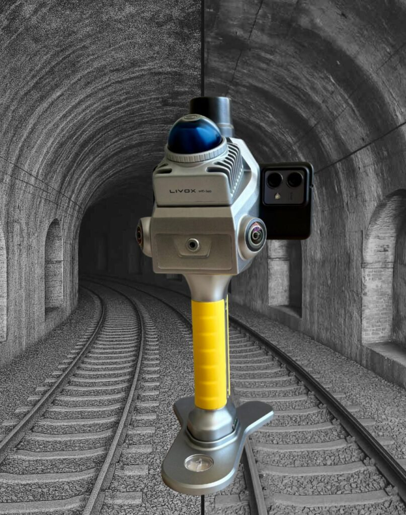
L-40 Handy SLAM Laser Scanner
Handheld SLAM for precision surveying and real-time 3D visualization.
The L-40 Handy SLAM is an advanced 3D laser scanner built for spatial data capture, 3D modelling, and as-built documentation. Leveraging SLAM algorithms and Livox LiDAR technology, it captures up to 200,000 points per second with a 40-meter range. Features include a mechanical shutter for global exposure imaging, dual 16 MP sensors, RTK positioning, IP54 protection, and integrated mobile and desktop software for field control and post-processing.
Request a quote →
We reply within 24h with availability and best price.
Highlights
- LiDAR range 0.1–70 m · 360° H · –7° to 52° V FOV
- Up to 200,000 points/sec at 10 Hz
- 16 MP RGB camera · 140° H × 200° V FOV
- RTK accuracy: 0.8 cm horizontal · 1.5 cm vertical
- 256 GB SSD storage with expansion
- Lightweight 1.08 kg · IP54 dust/water protection
Technical specifications
| GNSS | Galileo, QZSS, NavIC, SBAS |
| Camera | Dual 1″ 16 MP CMOS sensors · 140° H × 200° V FOV |
| Weight | 1.08 kg |
| Shutter | Mechanical, global exposure |
| Storage | 256 GB SSD (expandable) |
| Pixel size | 2.4 µm |
| LiDAR range | 0.1–70 m |
| Field of view | 360° horizontal · –7° to 52° vertical |
| Operating time | Up to 150 minutes |
| Scanning speed | 200,000 pts/s at 10 Hz |
| LiDAR technology | Livox |
| Protection rating | IP54 |
| Software included | TopoGEOS Capture App (Android), TopoGEOS PointClouds Studio |
| RTK vertical accuracy | 1.5 cm |
| RTK horizontal accuracy | 0.8 cm |
⚡ Request a quote
L-40 — quote
Tell us configuration & quantity — we reply within 24h.